KASPROWY WIERCH FOR HIKING ENTHUSIASTS
Tourists planning a hiking trip to Kasprowy Wierch have several tourist trails to choose from:
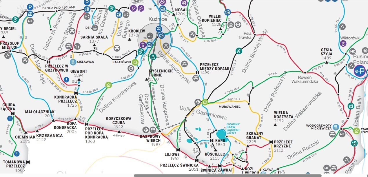
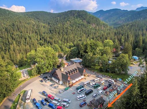
GREEN trail (3.30') through the Myslenickie Turnie runs under the cable car route. It starts in Kuznice, initially runs along the ski track, after about 1.30' it passes the intermediate station of the cable car at Myslenickie Turnie (1,360 m above sea level) and then climbs tiring along the edge of the Goryczkowa Valley to the very top of Kasprowy Wierch (1,987 m above sea level) under the meteorological observatory station. The observatory, built in 1938, is the highest building in Poland.
BLUE trail (3.40') through Boczan, Skupniow Uplaz and Hala Gasienicowa it leads from Kuźnice, next to the grocery store, over the bridge on the Bystra stream towards Nosal. After about 10', the trail turns right and leads initially through the forest (fir trees) to Boczan and then along the ridge of Skupniowy Uplaz, with a nice view of the Olczyska Valley and Kopieniec (1,328 m above sea level). After about 1.45', the trail reaches the Miedzy Kopami Pass - Karczmisko - (1,499 m above sea level) and joins the yellow trail. From Karczmisko, a wide path leads to the Murowaniec shelter. Here the trail turns yellow (blue signs lead to the Zawrat Pass) and after about 90 minutes it leads tired tourists to the cable car building at the top of Kasprowy Wierch. And there, cold beer, Coca-Cola, pizza, toilet and other achievements of civilization await brave hikers. You can return from Kasprowy Wierch to Kuźnice by cable car. However, please note that during the holidays, in the afternoon at the top of Kasprowy Wierch, similar queues form as in the morning in Kuznice, so it is worth starting the trip very early in the morning.
YELLOW trail (3.45') through the Jaworzynka Valley and Hala Gasienicowa starts in Kuznice, at the wooden kiosk where you buy entry tickets to the Tatra National Park (behind the grocery store and the bridge over the Bystra stream). The yellow trail leads through the Jaworzynka Valley - initially along its bottom and then climbs serpentines to its forested slope. At an altitude of 1,499 m above sea level. at the pass Miedzy Kopami, it connects with the above-described blue trail leading from Kuznice through Boczan and as a blue trail leads to the Murowaniec shelter, and then again with yellow signs to the top of Kasprowy Wierch.